Flooding in Sakon Nakhon Province (11-15 June 2025)
ช่วงวันที่ 9-13 มิถุนายน 2568 ประเทศไทยมีฝนตกหนักถึงหนักมากกระจายตัวในทุกภาคของประเทศ ซึ่งเป็นผลมาจาก 3 ปัจจัยหลัก ประกอบด้วย
1) ร่องมรสุม ที่พาดผ่านบริเวณภาคเหนือและภาคตะวันออกเฉียงเหนืออย่างต่อเนื่อง
2) มรสุมตะวันตกเฉียงใต้ ที่พัดปกคลุม
ทะเลอันดามัน ประเทศไทย และอ่าวไทยมีกำลังค่อนข้างแรง
3) พายุไต้ฝุ่น“หวู่ติบ (WUTIP)” แม้จะไม่ได้แคลื่อนตัวเข้าสู่ประเทศไทยโดยตรง แต่อิทธิพลของพายุกลับเป็นปัจจัยสำคัญที่ทำให้เกิดฝนตกหนักมากในช่วงวันที่ 12-13 มิถุนายน 2568 จนเป็นเหตุให้เกิดน้ำท่วม
บริเวณจังหวัดสกลนคร โดยอำเภอที่มีฝนตกหนักมาก (ปริมาณฝนเกิน 90 มิลลิเมตรต่อวัน) ประกอบด้วย อ.อากาศอำนวย อ.พังโคน อ.เมืองสกลนคร จ.สกลนคร อ.ธาตุพนม อ.เรณูนคร อ.เมืองนครพนม จ.นครพนม
During 9-13 June 2025, Thailand experienced widespread heavy to very heavy rain across all regions of the country due to three primary factors:
1) Monsoon trough persistently lying across the North and the Northeast
2) Relatively strong southwest monsoon prevailing over the
Andaman Sea, Thailand, and the Gulf of Thailand
3) Typhoon “WUTIP”, although it did not move directly into Thailand, its influence became a major factor, resulting in very heavy rain from 12 to 13 June 2025. This heavy rain caused flooding in Sakon Nakhon Province. Districts facing very heavy
rain exceeding 90 millimeters per day included Akat Amnuai, Phang Khon, and Mueang Sakon Nakhon in Sakon Nakhon Province; That Phanom, Renu Nakhon, and Mueang Nakhon Phanom in Nakhon Phanom Province.
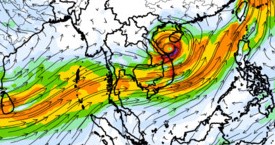
(Weather Map on 13 June 2025 at 00UTC showed the monsoon trough lay acress the North and the Northeast into "WUTIP")
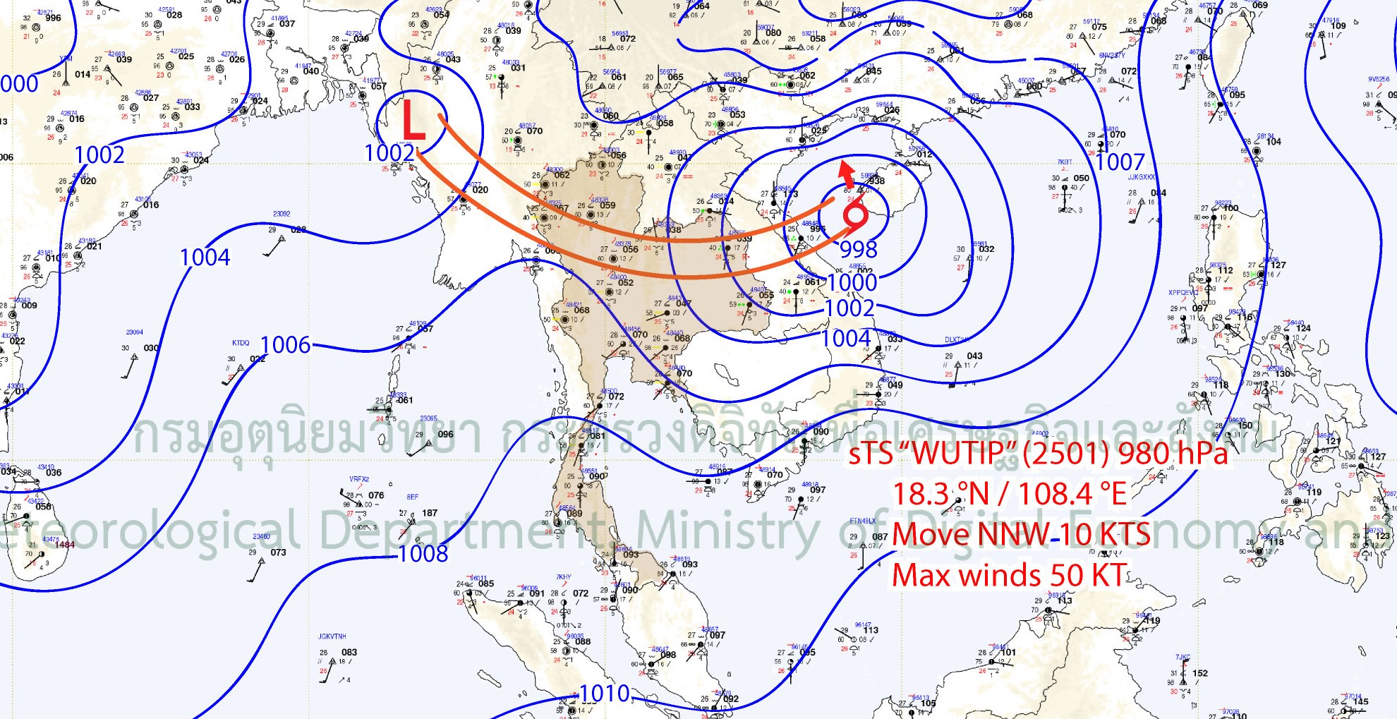
(Wind Speed Map on 13 June 2025 at 07:00 hrs shows a significantly strengthened southwest monsoon due to the influence of Tropical Storm Wutip)
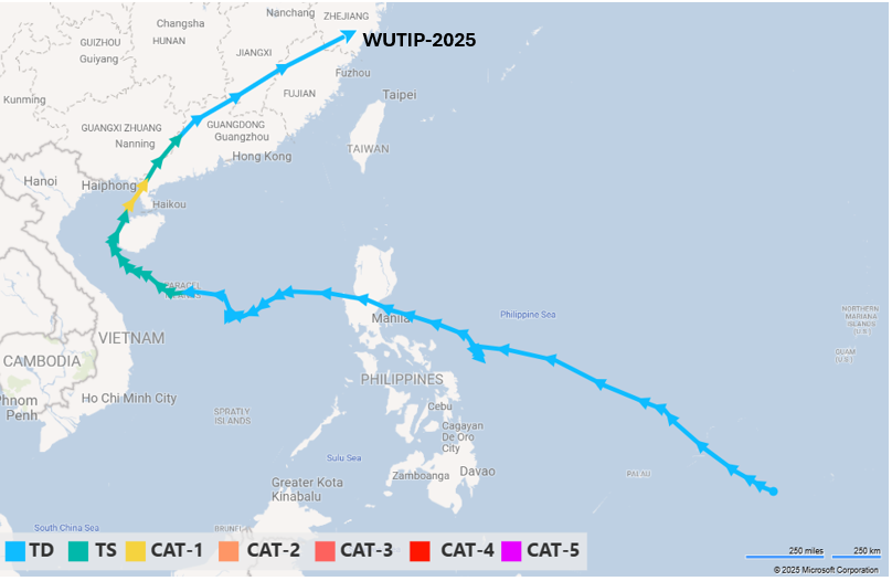
(Typhoon Wutip Track Map, which formed on 3 June 2025 and dissipated on 15 June 2025)
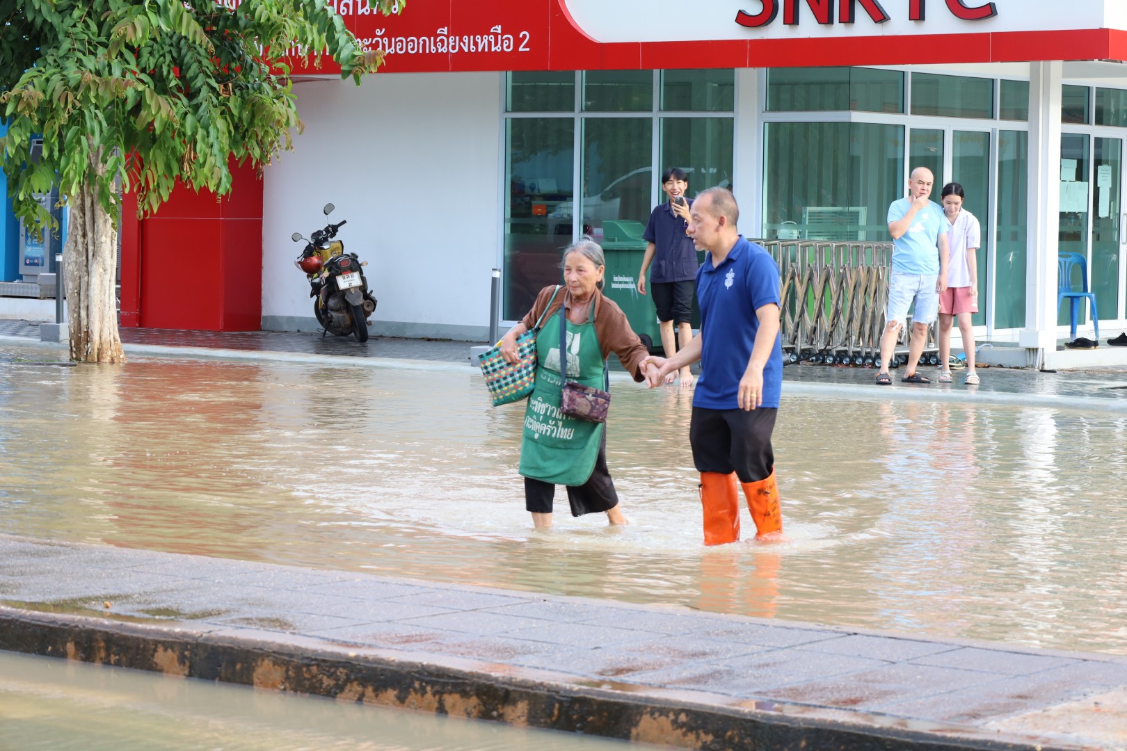
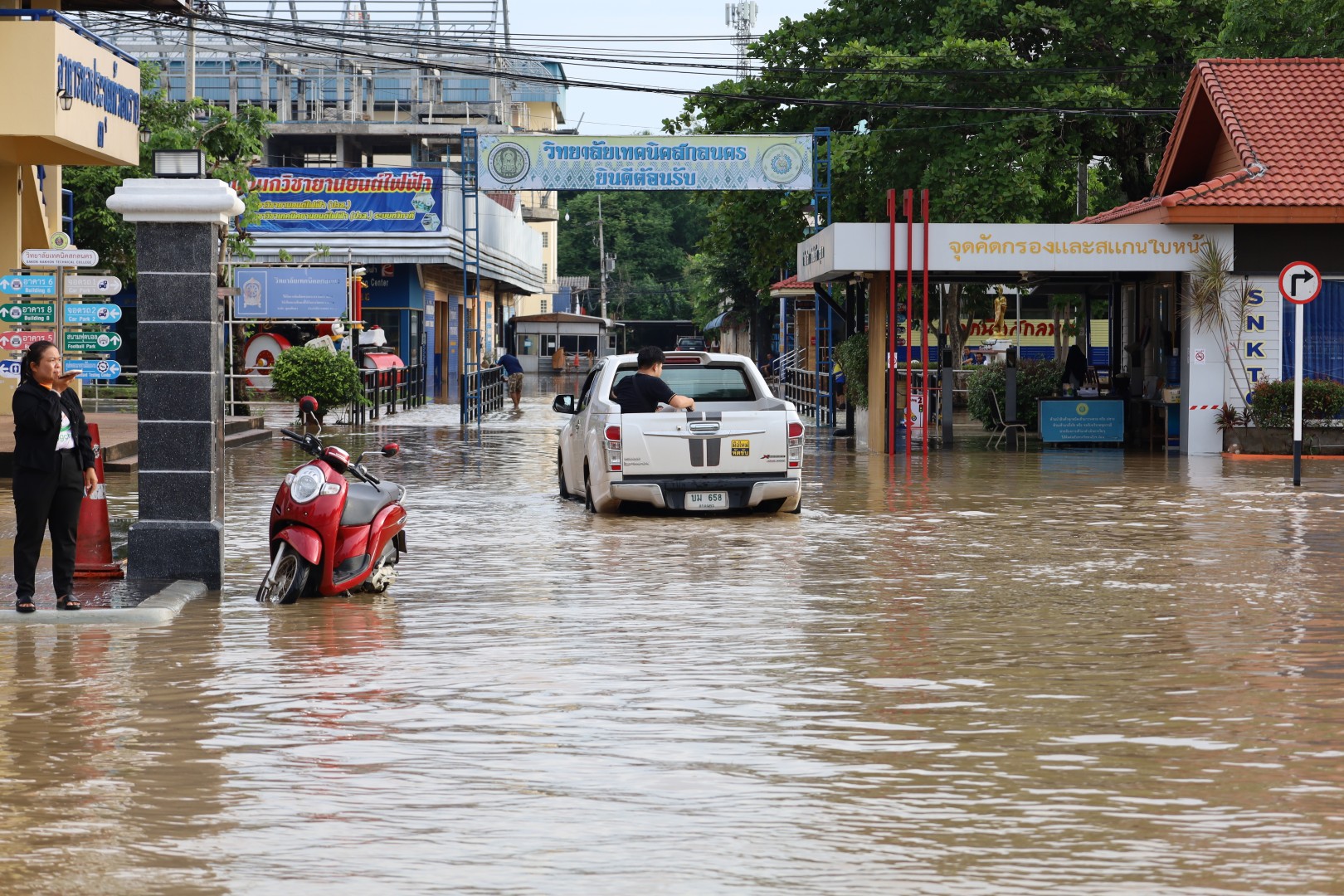
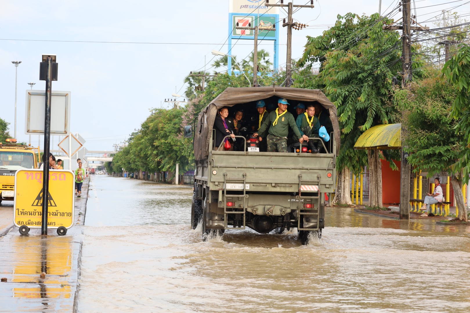
ตามรายงานของผู้สื่อข่าวของหนังสือพิมพ์กรุงเทพธุรกิจได้รายงานเมื่อวันที่ 13 มิถุนายน 2568 พบว่าหลายพื้นที่ของ จ.สกลนคร ประสบกับภาวะน้ำท่วมฉับพลัน สร้างความเสียหายต่อพื้นที่เกษตรกรรม ถนน และทรัพย์สินของประชาชนในหลายอำเภอ ประกอบด้วย
1) อ.พรรณานิคม เกิดน้ำล้นตลิ่งเข้าท่วมพื้นที่เกษตรกรรมใน 4 ตำบล ได้แก่ ตำบลบะฮี ตำบลพรรณา ตำบลนาหัวบ่อ ตำบล
เชิงชุม รวมทั้งมีถนนเพื่อการเกษตรขาด 1 เส้นทาง ที่ ต.ไร่ และเกิดน้ำท่วมคอกปศุสัตว์ ที่ ต.หัวบ่อ
2) อ.ส่องดาว เกิดน้ำท่วมนาข้าวในพื้นที่บ้านโพนศรี อย่างไรก็ตาม ณ วันที่รายงานยังไม่พบความเสียหายร้ายแรงเกิดขึ้น
3) อ.วาริชภูมิ คันคูห้วยกุดแร้งขาดที่จุดก่อสร้างฝายของชลประทานจังหวัดสกลนคร บ้านดอนยาวใหญ่ ตำบลหนองลาด รวมทั้งที่ลำห้วยปลาหางในพื้นที่ตำบล
ปลาโหล เกิดน้ำล้นตลิ่งท่วมนาข้าวและพื้นที่ทางการเกษตร
4) อ.โพนนาแก้ว เกิดพายุฝนพัดหลังคาบ้านของราษฎรพัง 1 หลัง ที่หมู่ 4 ตำบลนาแก้ว
5) อ.วานรนิวาส พบพื้นที่น้ำท่วมขังรวม 6 ตำบล 23 หมู่บ้าน พื้นที่เกษตรกรรมที่ถูกน้ำท่วมรวมกว่า 3,180 ไร่
A reporter from Bangkok Biz News reported on 13 June 2025 that several areas of Sakon Nakhon Province were hit by flash floods, causing damage to agricultural lands, roads, and residents’ property in many districts as follows:
1) Phanna Nikhom District
Water overflowed riverbanks, flooding agricultural areas in four subdistricts: Ba Hi, Phanna, Na Hua Bo, and Choeng Chum. Additionally, one
agricultural road in Rai Subdistrict was damaged, and livestock facilities in Hua Bo Subdistrict were inundated.
2) Song Dao District
Rice fields in Ban Phon Sri village were flooded. However, as of the reporting date, no severe damage had been reported.
3) Waritchaphum District
The embankment of Huai Kud Raeng was damaged at the weir construction site of the Sakon Nakhon Provincial Irrigation Department, Ban Don Yao
Yai Village, Nong Lat Subdistrict. Additionally, Huai Pla Hang in Pla Lo Subdistrict overflowed, flooding rice fields and agricultural lands.
4) Phon Na Keo District
One house roof in Moo 4, Na Kaeo Subdistrict, was damaged by a rainstorm.
5) Wanon Niwat District
Flooding was reported in 6 subdistricts and 23 villages, with over 3,180 rai of agricultural areas submerged.
นอกจากทำให้เกิดน้ำท่วมในหลายพื้นที่แล้ว ฝนตกหนักที่เกิดขึ้นในบริเวณจังหวัดสกลนคร ยังส่งผลทำให้มีน้ำไหลลงเขื่อนเพิ่มมากขึ้น โดย
1) เขื่อนน้ำอูน อ.พังโคน ปริมาณน้ำกักเก็บเพิ่มขึ้นจาก 45% เป็น 53% ของความจุเขื่อน ซึ่งอยู่ในเกณฑ์น้ำปานกลาง
2) เขื่อนน้ำพุง อ.พูพาน ปริมาณน้ำกักเก็บ
เพิ่มขึ้นจาก 21% เป็น 23% ของความจุเขื่อน ซึ่งอยู่ในเกณฑ์น้ำน้อยวิกฤต
3) อ่างเก็บน้ำห้วยทรายขมิ้น อ.เมืองสกลนคร ปริมาณน้ำกักเก็บเพิ่มขึ้นจาก 55% เป็น 126% ของความจุเขื่อน
4) อ่างเก็บน้ำห้วยซวง อ.วานรนิวาส ปริมาณน้ำกักเก็บเพิ่มขึ้นจาก 50% เป็น 103% ของความจุเขื่อน ทั้งนี้อ่างเก็บน้ำ
ห้วยทรายขมิ้นและอ่างเก็บน้ำห้วยซวง เริ่มเกิดน้ำล้นเขื่อนตั้งแต่วันที่ 15 มิถุนายน 2568 และยังคงมีน้ำล้นเขื่อนอย่างต่อเนื่องไปจนถึงช่วงสิ้นเดือน
5) อ่างเก็บน้ำห้วยเดียก อ.เมืองสกลนคร ปริมาณน้ำเพิ่มขึ้นจาก 77% เป็น 101% ของความจุเขื่อน โดยเกิดน้ำล้นเขื่อนในช่วงวันที่ 15-18 มิถุนายน 2568
In addition to flooding in several areas, the heavy rain in Sakon Nakhon Province also resulted in an increased inflow into several dams.
1) Nam Un Dam in Phang Khon District: water storage increased from 45% to 53% of its capacity, which was at a moderate level.
2) Nam Pung Dam in Phu Phan District: water storage increased
from 21% to 23% of its capacity, which was at a critically low level.
3) Huai Sai Kamin Reservoir, Mueang Sakon Nakhon District: water storage increased from 55% to 126% of its capacity.
4) Huai Suang Reservoir, Wanon Niwat District: the water storage increased from 50% to 103% of its capacity. Both Huai Sai Khamin
Reservoir and Huai Suang Reservoir began overflowing on 15 June 2025, with the overflow continuing through the end of the month.
5) Huai Diak Reservoir, Mueang Sakon Nakhon District: the water storage increased from 77% to 101% of its capacity, with overflow occurring during 15-18 June 2025.
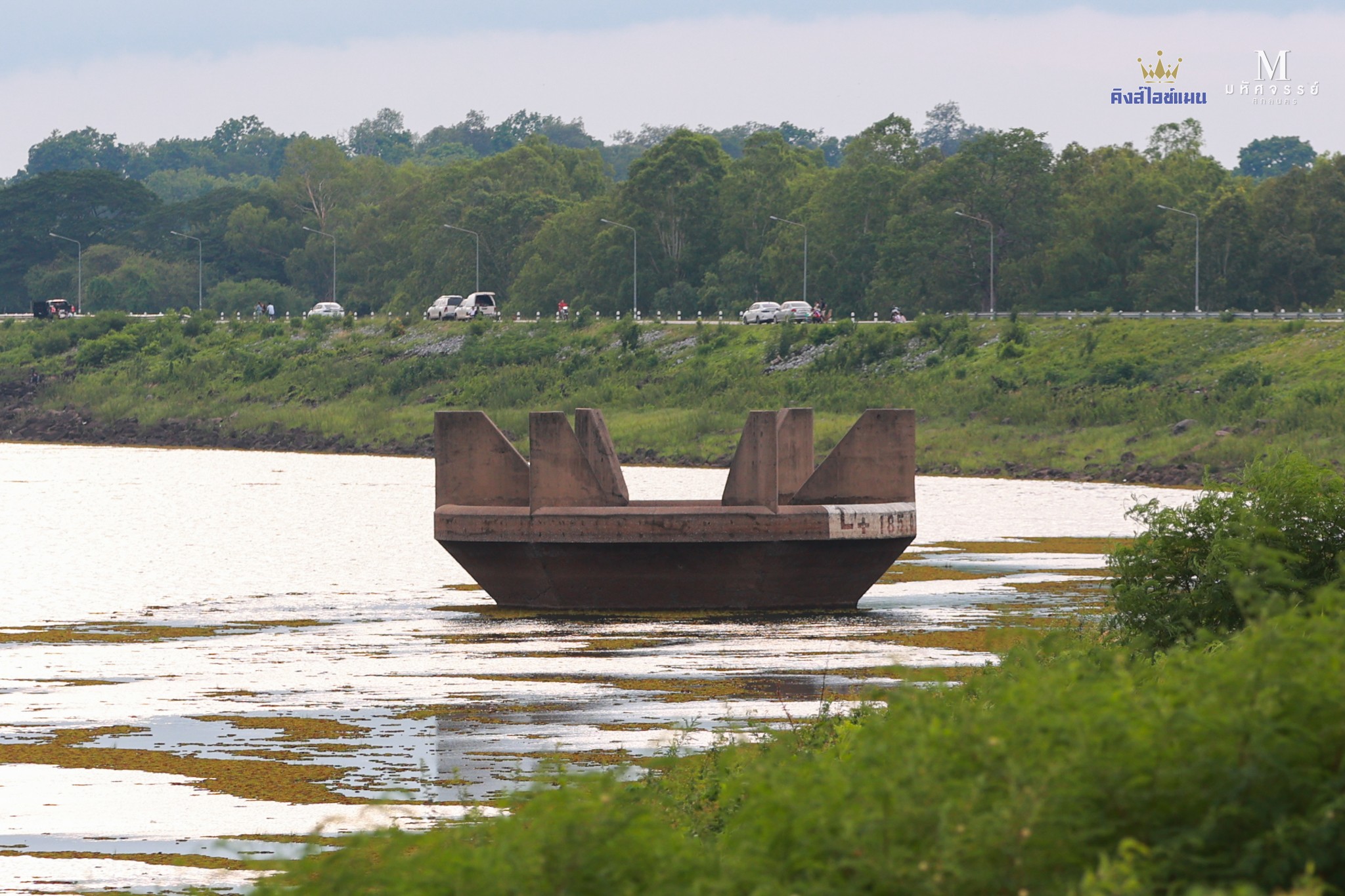
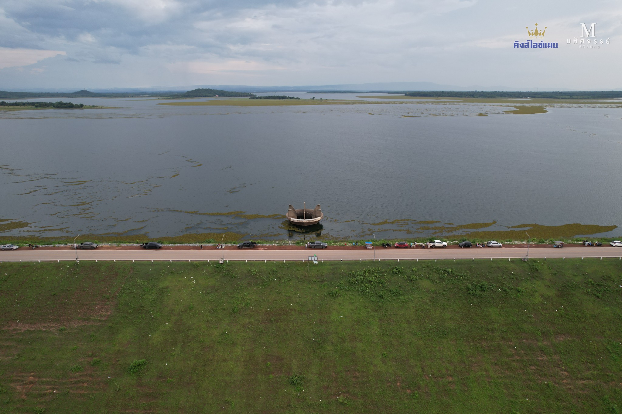
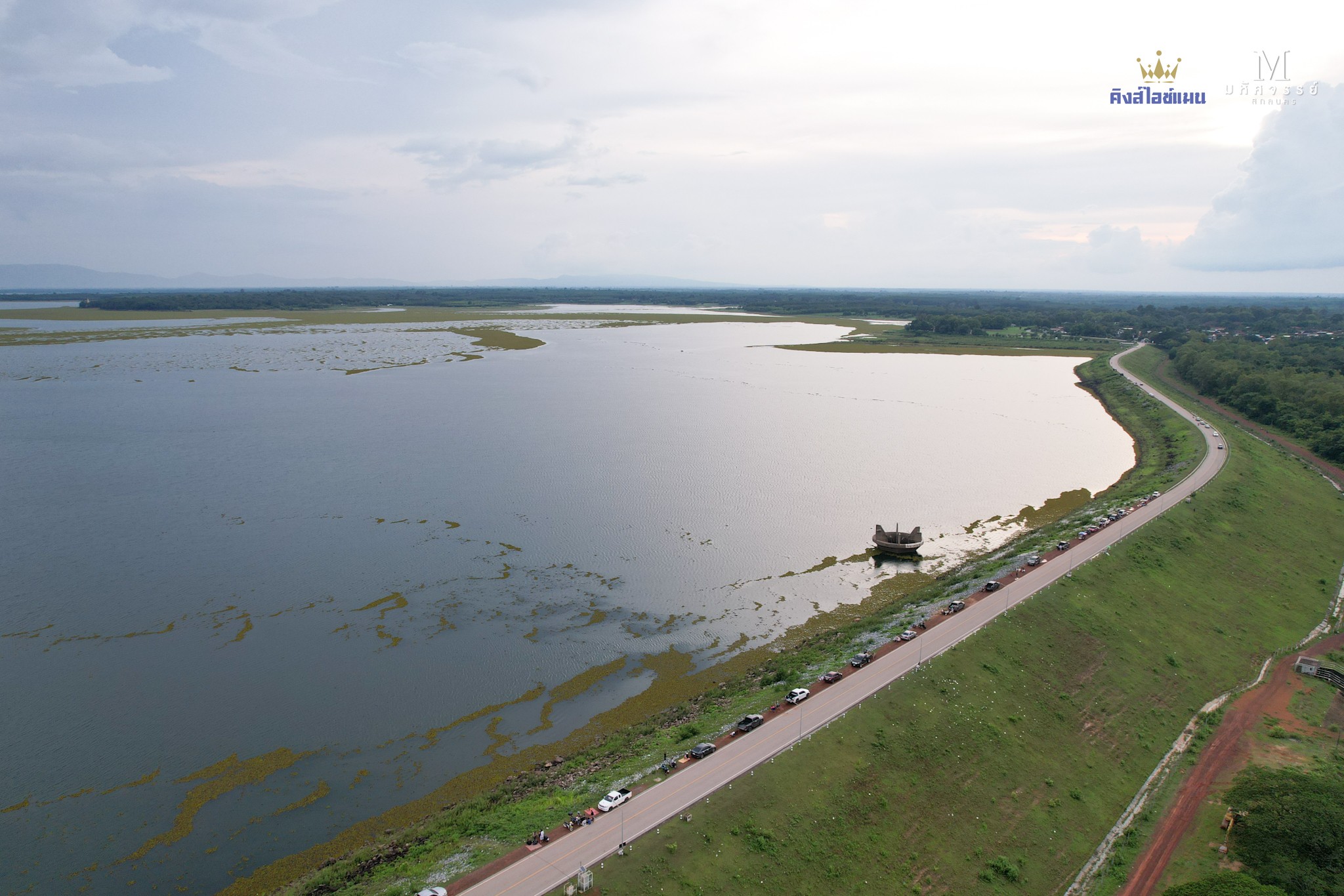
Water level at Nam Oon Dam, Phang Khon District, Sakon Nakhon Province, as of 21 June 2025 at 18:00 hrs. [Source: Facebook Mahatsajan Sakon Nakhon]